


l
An epic journey thru Norway´s southwest. Fjords, highlands, mountains, small villages, and a big town. And not to forget incredible sunny weather.
Stavanger, 19th May
We spent our 1st night in Norway. Surprisingly, it’s been warmer here than the days we had in Denmark.
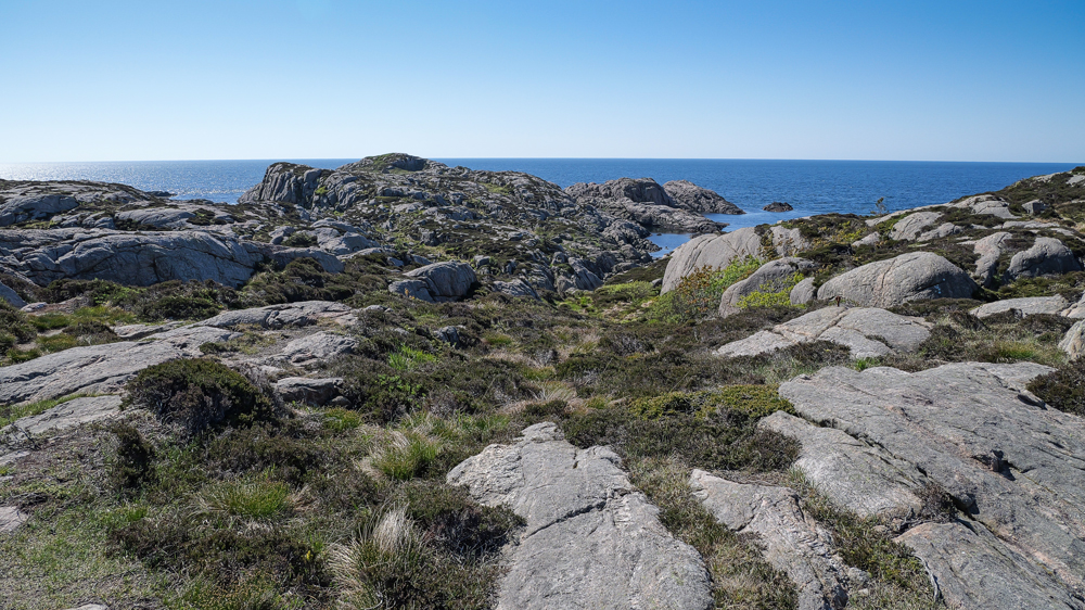
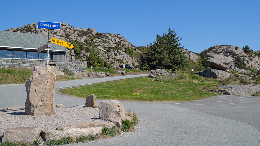
Time to move on. We definitely have to visit the country’s southernmost point: Nesvarden. Just a few km from our campsite, there’s a large parking area, followed by a ½ h hike to reach Norway’s world’s end to the south. Nothing overly spectacular, just for the honor to have visited.
Luckily, at the parking area we spot a road sign showing how many km are left to reach Norway’s northernmost point – we already made nearly half of it.
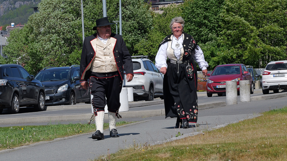
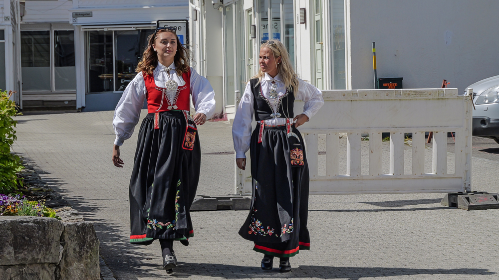
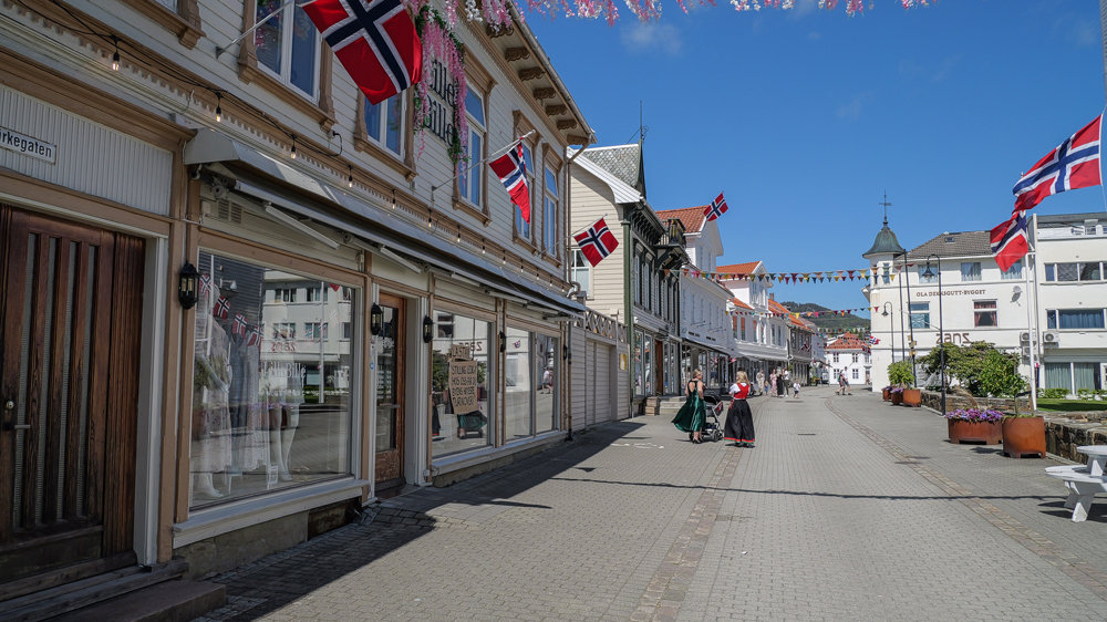
Today is Norway’s National Day. A public holiday, even when it falls on a weekend – the day when Norwies have to show all their patriotism they can develop for this occasion. From what we’ve heard, it’s a colorful spectacle not to be missed.
So, no reason to visit more southerenmost points and stuff like that … better we head into a town and see the locals celebrating patriotism at its best.
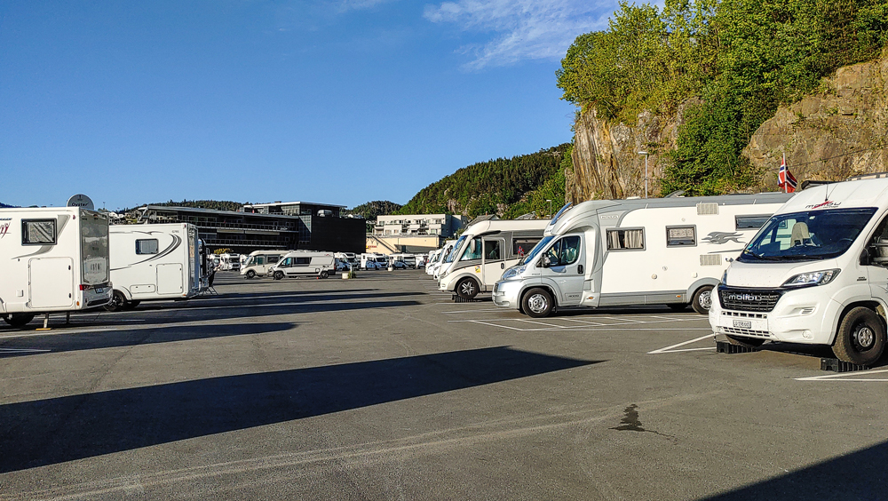
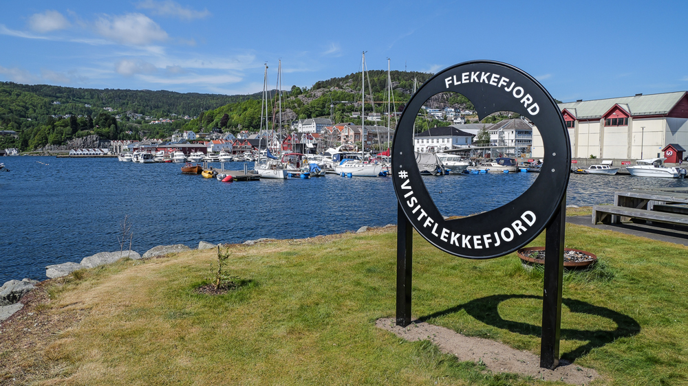
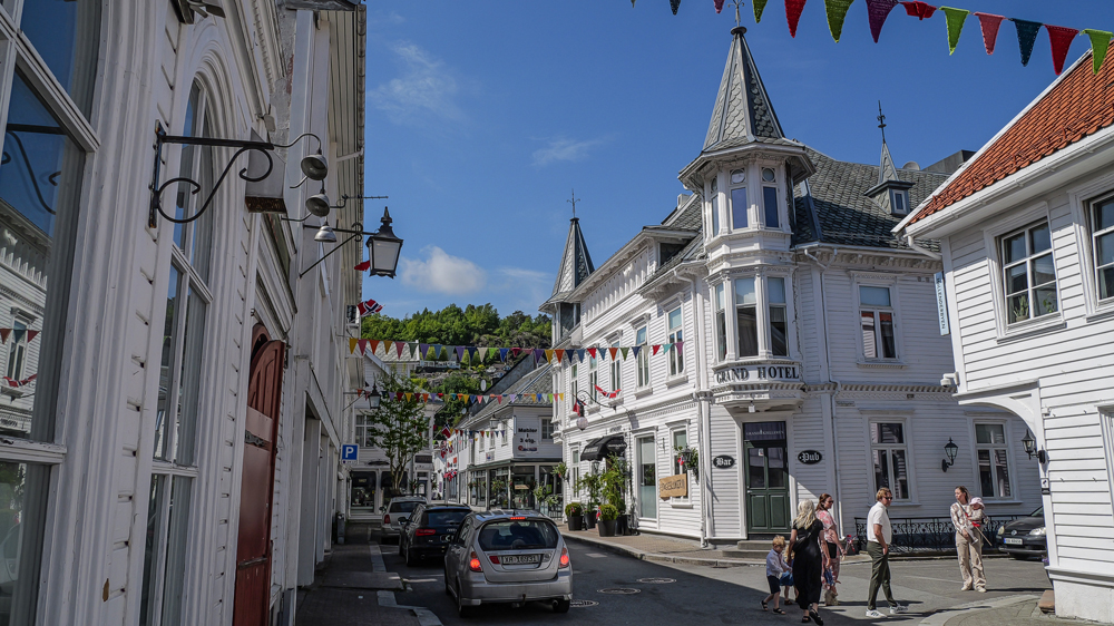
So, we’re on our way to Flekkefjord – a small town about 70km away. We head straight for the massive overnight parking for campers.
Well, we’re a bit surprised to find it’s almost completely packed with Norwies celebrating. Luckily, we manage to find a place to squeeze in.
Time to check out what the town and the events for the National Day have to offer. Eye-catching for sure, allmost everone’s dressed up in a pretty glamed-up way. Lots of girls in their traditional outfits, boys mostly wearing their best suits.
Somewhere, we even spot a mural featuring the ultimate local beauty.
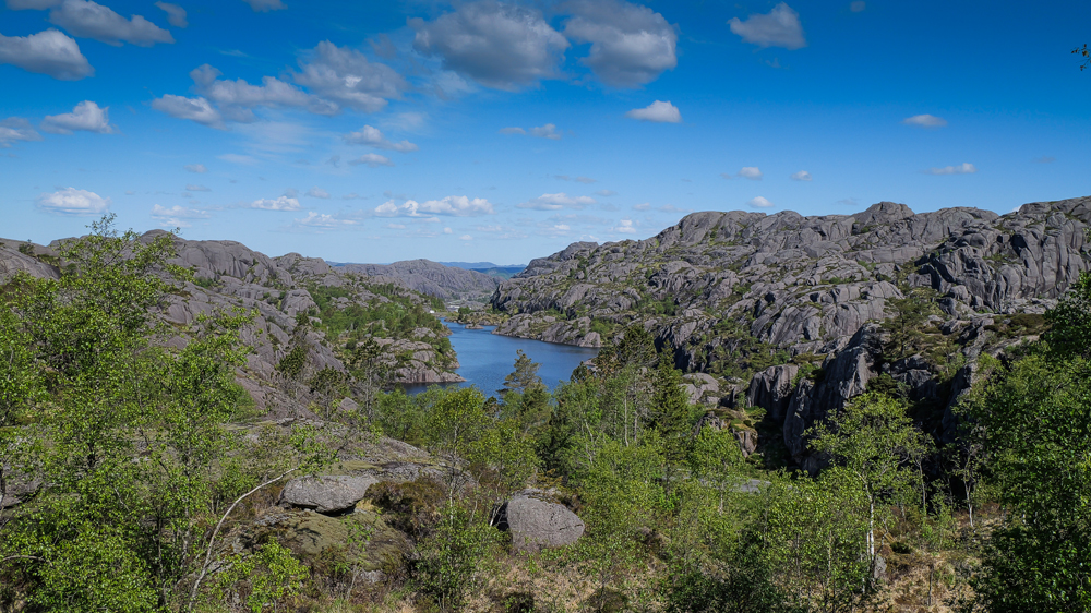
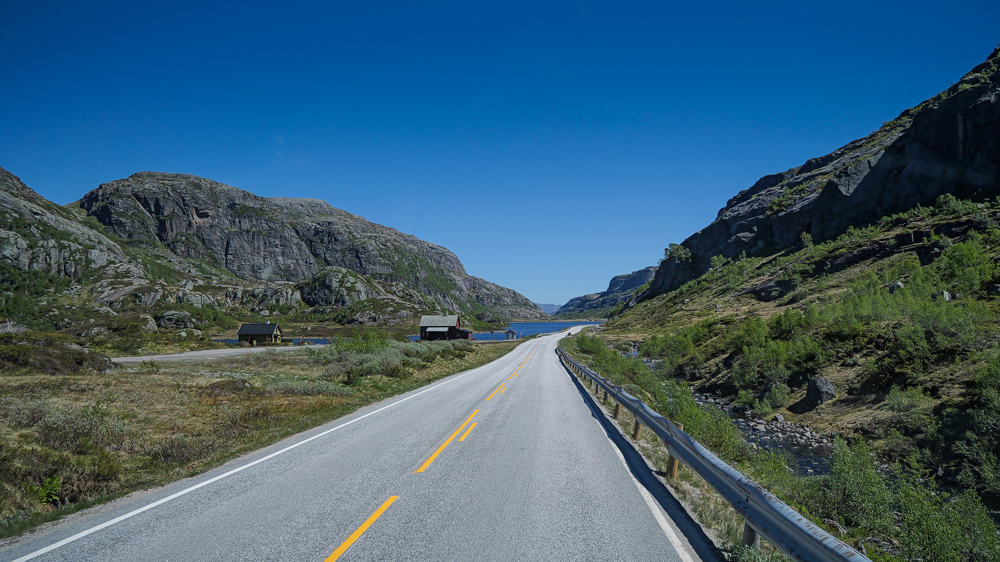
The next morning … Norway’s National Day is on the ash heap of history, and we’re off to Stavanger. About 130 km along the coast – 1 of the country’s famous Scenic Routes, with epic landscapes, endless skies, and tiny little villages along the way.
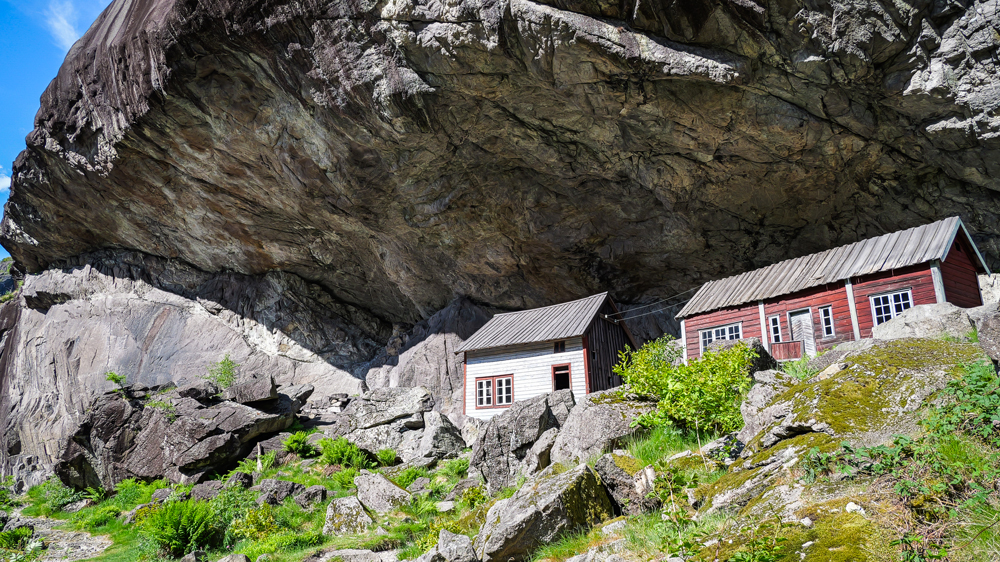
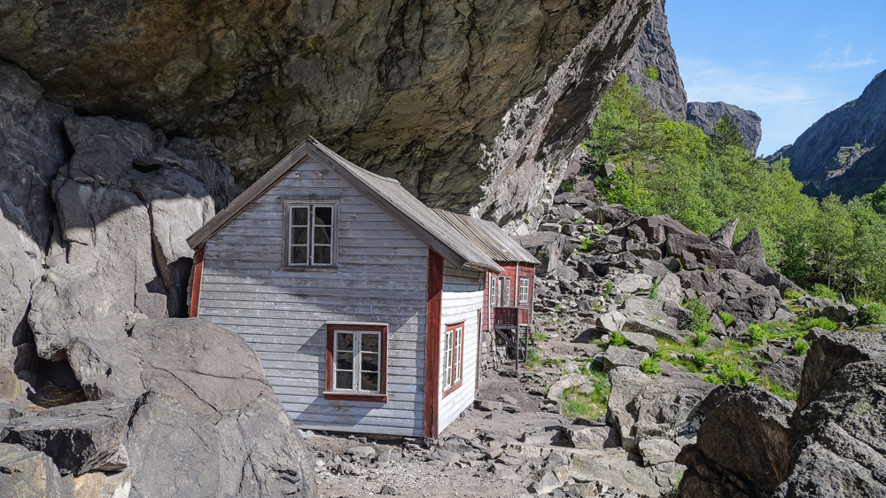
Soon we arrive in Helleren. If you take Norwegian tourism ads seriously, it’s an absolute must-see. 2 traditional houses built right under an overhanging rock. So, the guys back then didn’t even need waterproof roofs. Great idea. Today, no one seems to care much anymore – the houses are abandoned.
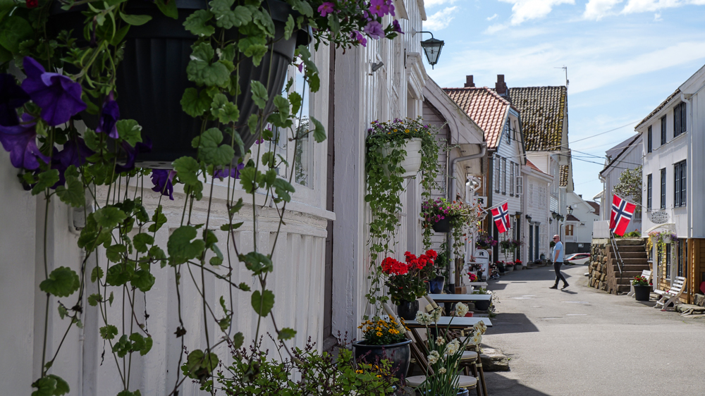
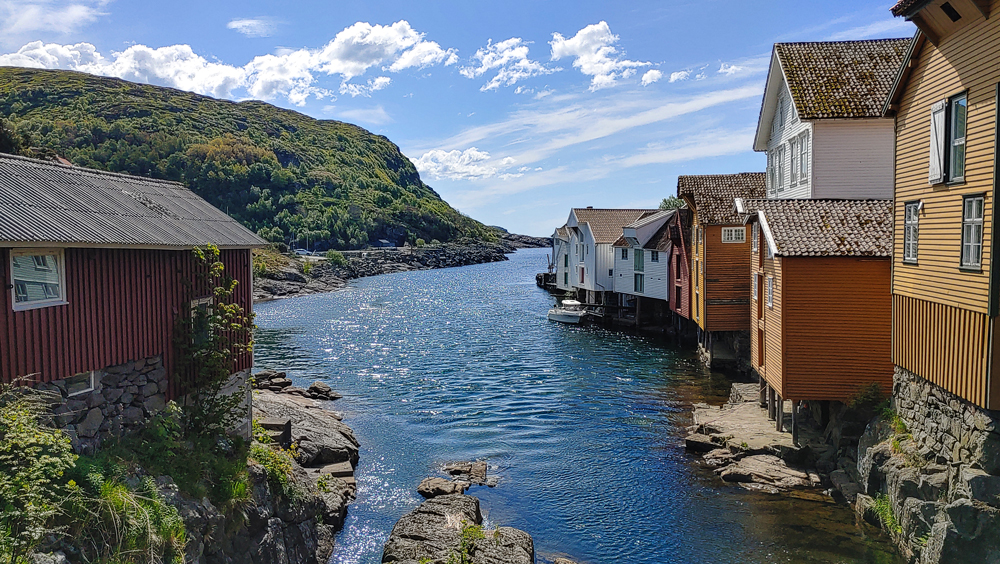
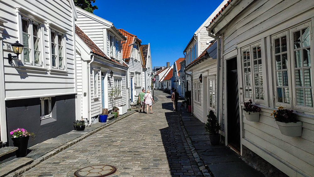
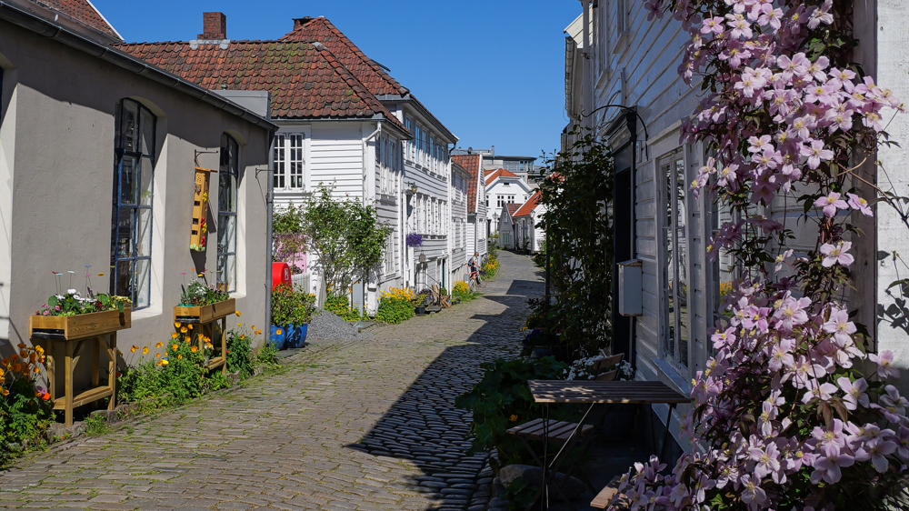
A little later, the next must-see spot: the tiny village of Sogndalstrand. True, it looks pretty charming with all the neat wooden houses. But no clue if there are any locals actually living here – we only saw tourists sneaking along the main street.
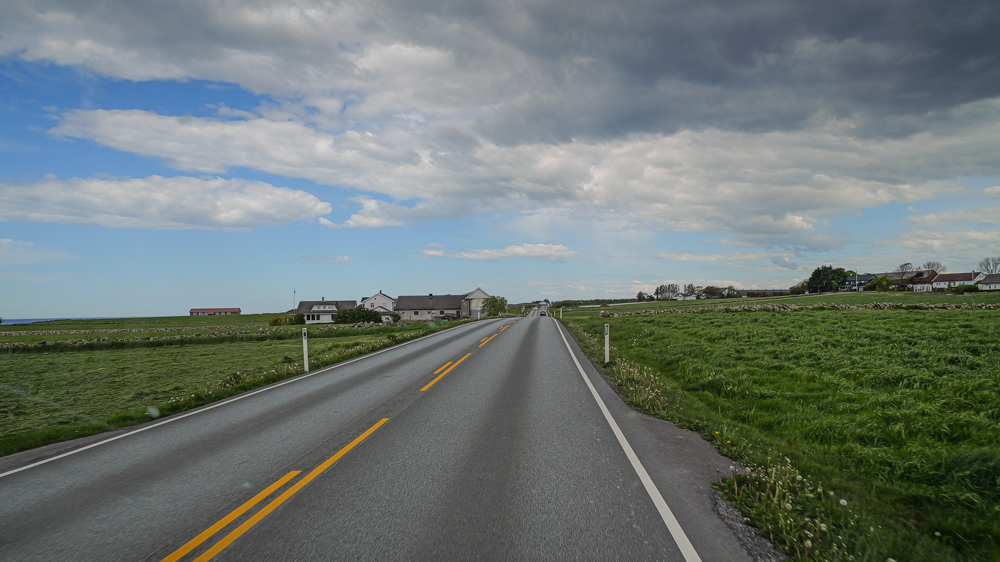
Then, just 1h to reach Norway’s oil capital, Stavanger. The drive takes you through flat farmland – not exactly the most exciting landscape.
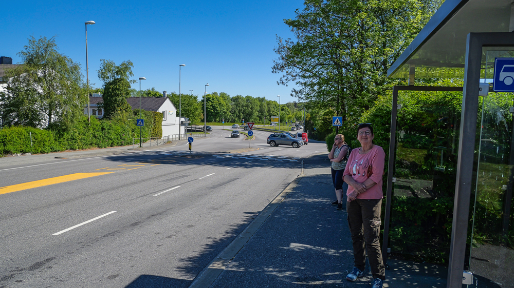
The next morning, we catch a bus from the campsite to the town center. It’s not too far, but you get the feeling they’re trying to sell you the whole bus, not just a single lousy seat for the few km. Yeah, prizes in Norway – almost as painful as in Swizzyland.
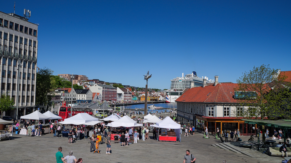
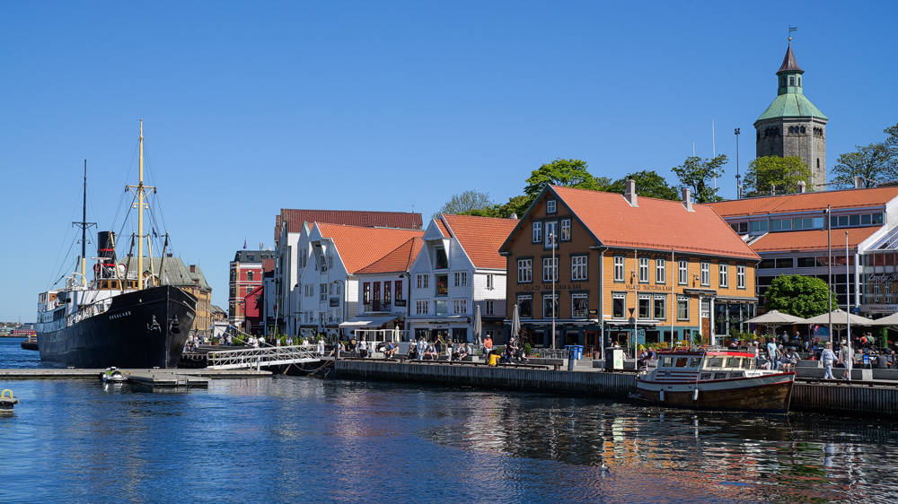
In town, we’re on our way to Stavanger’s harbor. Slightly surprised to see a beautiful cruise ship. Sure, we know stuff like that happens in Norway – but still, such a massive ship. Later, we find out that 8000 British citizens are on board, apparently so tired of Brexit and right-wing populism that they escaped their beloved country.
Fortunately, most of these cruise shippys have little interest or intention to visit the town. They just sneak a few meters from the ship or head straight to the nearby market stalls, selling all those Chinese souvenirs made especially for cruise shippys in Norway.
And then there are the adventurers – those guys hop on a speedboat tour to Lysefjord, with guaranteed return before their ship sails off to new horizons.
Well, we head for Stavanger’s old town, leaving the monster ship and these cruise shippys behind us.
Of course, even in the background, the cruise ship still kind of dominates the scene.
On, to the other side of the harbor. Looks like the heart of the local gourmet scene.
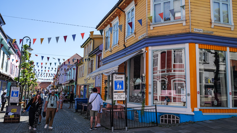
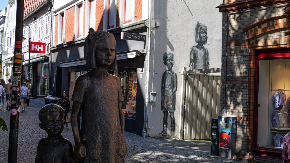
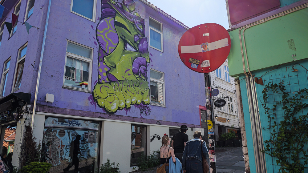
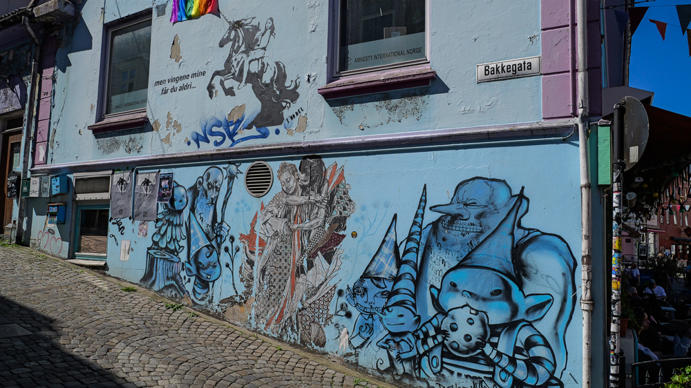
Finally, we check out the town’s street art. Even though it’s strongly supported by the City Council, it doesn’t really compare to the murals you find in South America.
Preikestolen, 22nd May
Our visit to Stavanger is coming to an end. Enough with the cruise shippys clogging the roads on their search for a made-in-China souvenir for Auntie Jane’s grandma.
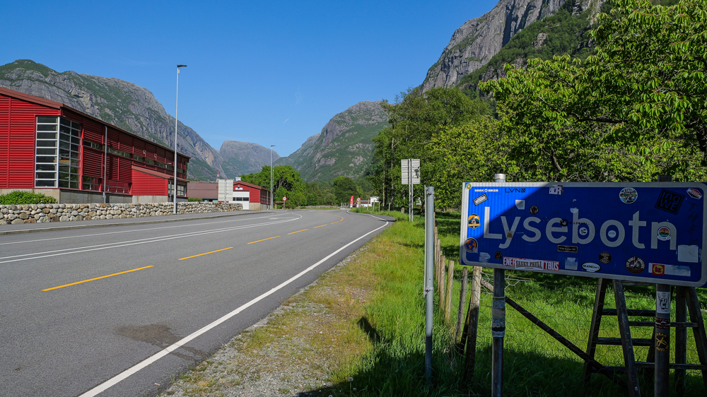
Now we’re off to the tiny village of Lysebotn. Only a few lost souls live there, and in winter, the only way in is by boat.
It’s just a 2h drive on a pretty spectacular road. Once you leave Stavanger’s suburbs, on a rather narrow road thru a valley parallel to the fjord. Then it climbs up to a mountain pass. Well, not super high, just around 700 – 900 m. But the landscape changes dramatically – barren tundra, even some patches of snow lingering in shady places.
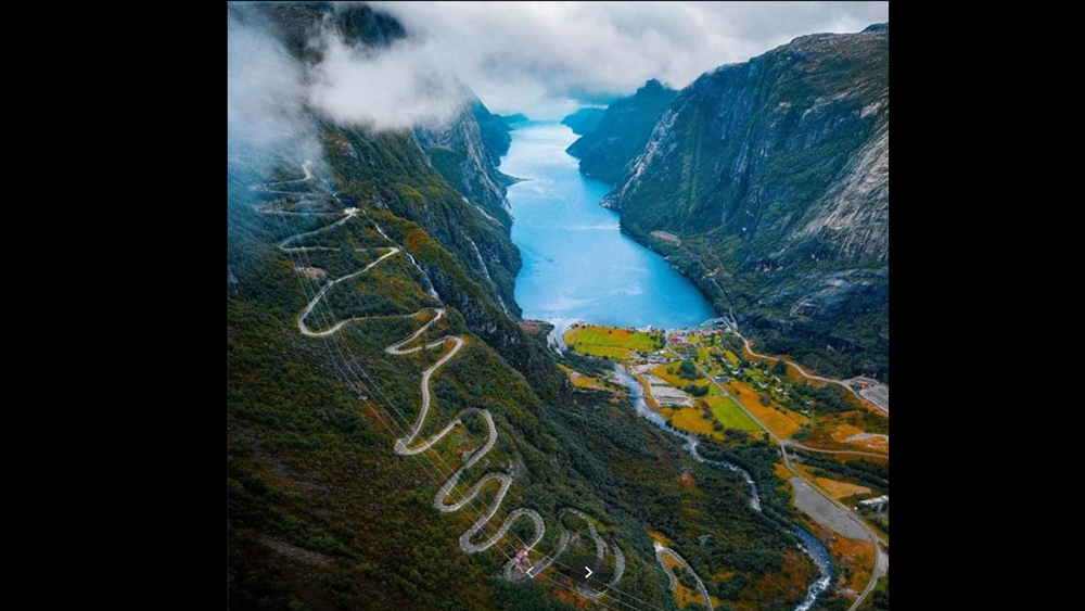
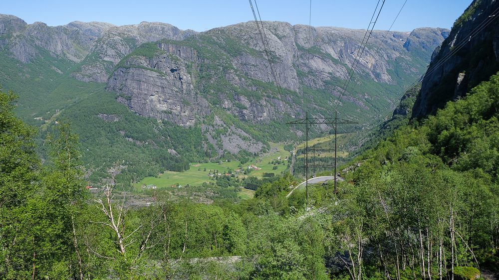
Then comes what the internet calls 1 of the most spectacular roads in Norway: the 800m descend from the highlands down to the village of Lysebotn at sea level. 27 switchbacks packed into just 7km, winding down sheer cliffs where the slightest lapse could easily mean a one-way flight down 100s of meters. Definitely a stretch to take slow – and not after having enjoyed a 6-pack of lousy Norwegian beer.
Whatever. On the left, a picture borrowed from some unknown artist on the internet, showing how spectacular the drive is. On the right the reality – as we lived it.
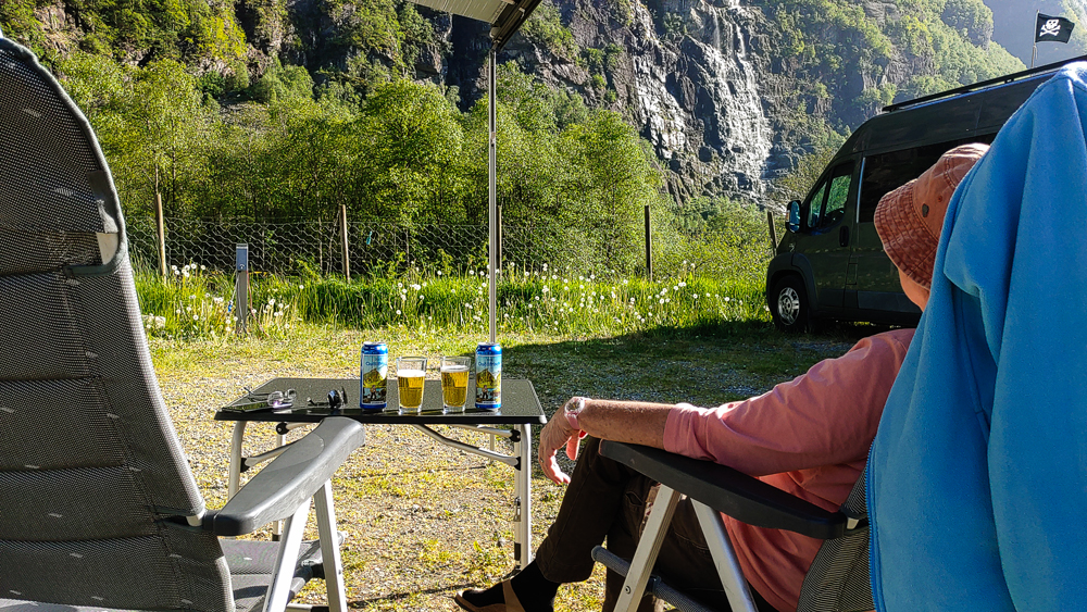
Arriving in Lysebotn, we head straight for the campsite. It’s not an exactly big 1, but still it seems to be the biggest establishment in town.
Then a stroll thru the village – just along the 1 road, the main street down to the pier and back. That’s it.
Later, it’s time for a well-deserved beer.
An afternoon and evening in Lysbotn is definitely enough to get to know each’n’every house, its inhabitants, and their family sagas dating back to the days of the bad old Vikingers.
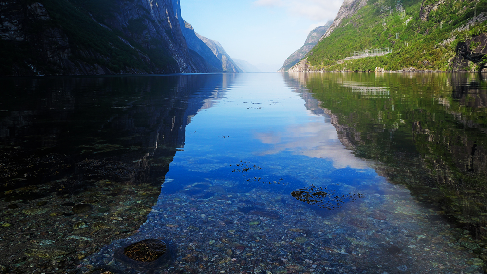
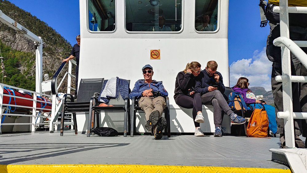
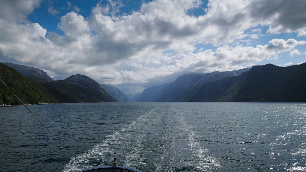
So, early the next morning we’re ready for the 2½ h ferry ride along Lysebotnfjord. Said to be 1 of the most epic tours in southern Norway.
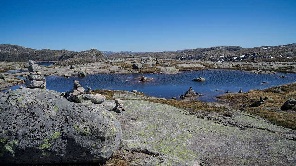
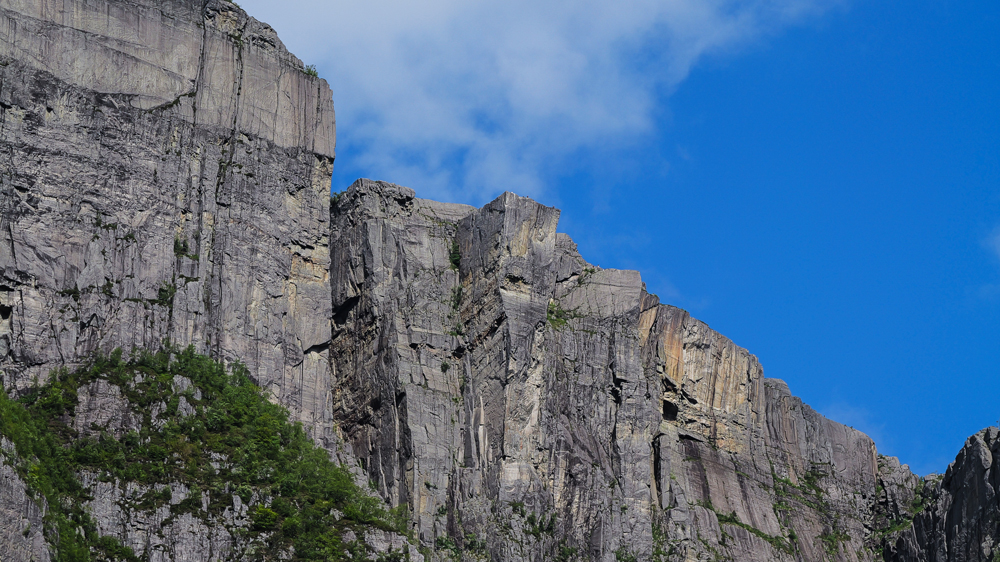
On the way, we pass below the famous Preikestolen Rock. This rock platform on a cliff a few 100m above sea level is probably 1 of the most visited spots in all of Norway. From the sea you can clearly see the outcrop – though honestly, it just looks like any ordinary rock.
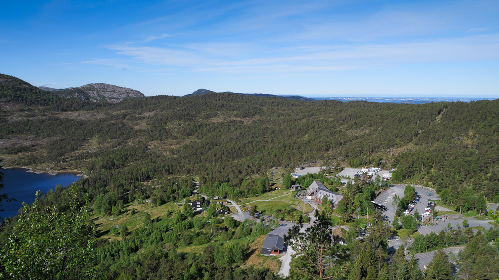
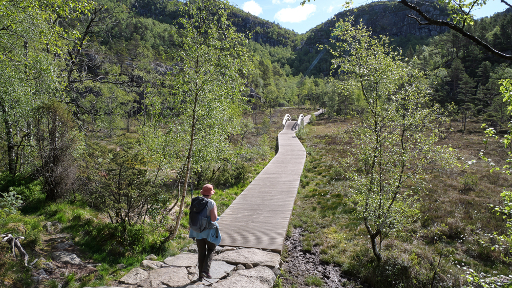
Soon later, we arrive in Foresand – the final destination of our ferry cruise. From there, just a couple of km to reach Preikestolen Camping. A huge campsite – luckily, nearly empty this time of the year.
Early the next morning, we’re ready to set off for a hike. Initially, we had planned to skip this major tourist hotspot. The idea of 1000s of cruise shippys and selfie-hunters crowding the famous rock didn’t sound too appealing.
But, during our ferry ride thru Lysebotnfjord we caught a glimpse of the alternative hike along the mountain ridge, the Panorama Trail. Even though it’s advertised as the newer, better option to the overrun Preikestolen, it didn’t look all that promising either.
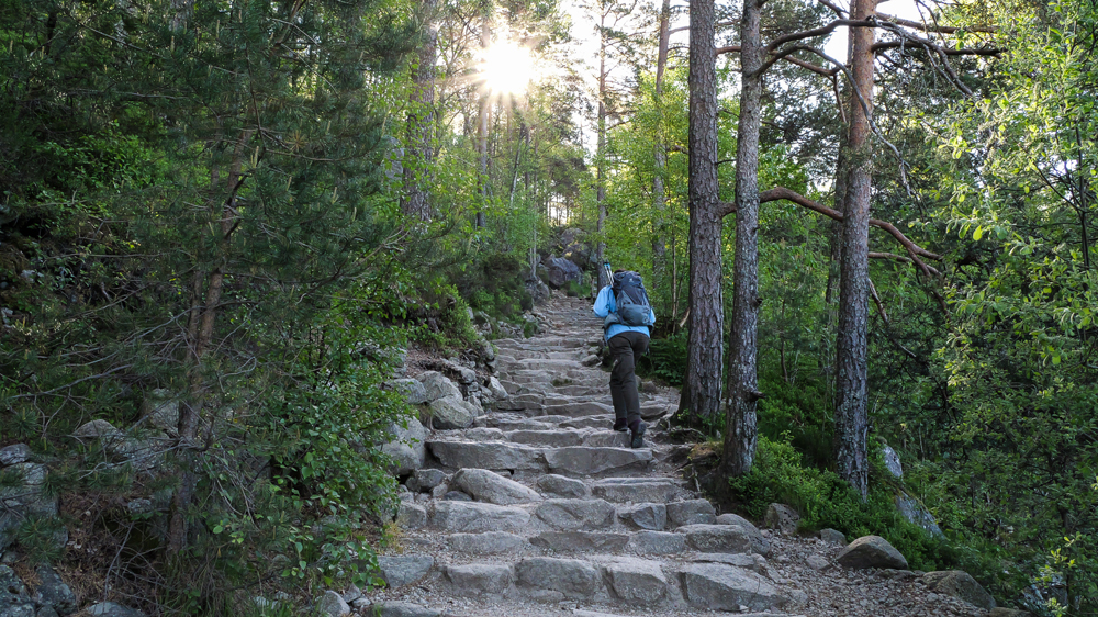
So, early in the morning, we’re on our way to the Preikestolen trailhead – hoping to beat the crowds from all these tours and cruise ships coming from Stavanger. A short drive to the massive parking lot. We quickly realize we’re not the 1st ones there. A few cars are already parked, but still not bad. Then comes the surprise: the parking fee. It’s even higher than in some overprized Croatian towns that seem to specialize in squeezing every last cent out of innocent tourists.
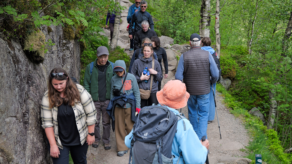
Then we’re off towards the famous rock. Surprisingly, there aren’t many people on the trail. About 2h to get there, following a partly overdeveloped path and lots of uneven stone stairs.
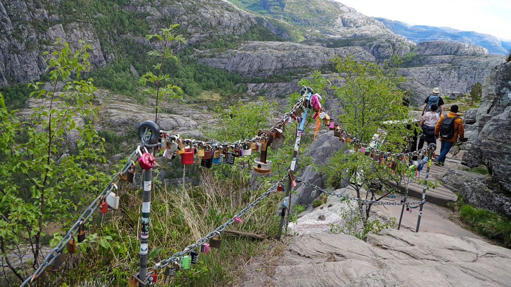
Shortly before reaching Preikestolen, there’s a section secured with chains. The perfect spot for lovers to reiterate their eternal love with a padlock – maybe extra helpful for those who plan to risk Nirvana while chasing the ultimate selfie.
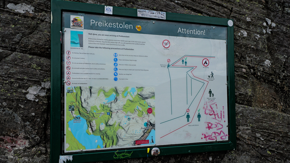
A bit further a big signboard explains exactly which areas to avoid on top of the rock – valid even if you’re too busy snapping selfies with your loved ones. Not sure if it’s also meant as a warning for anyone with suicidal thoughts.
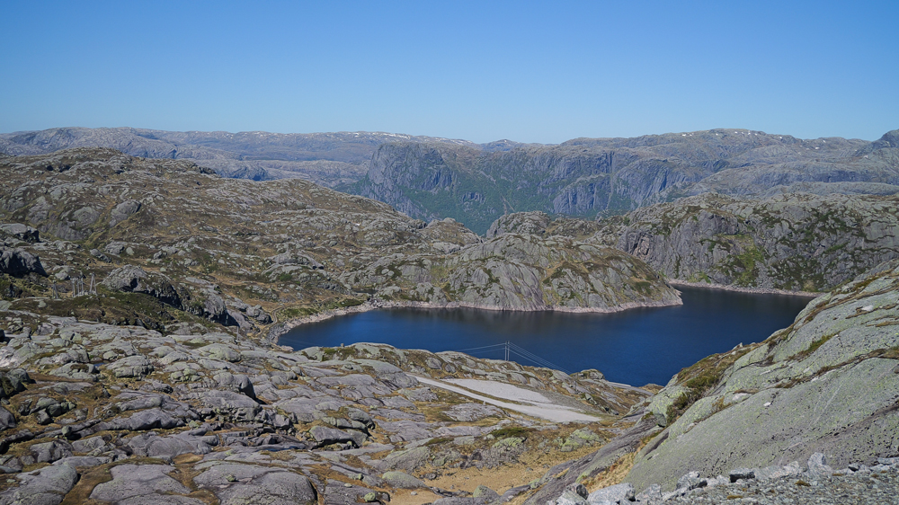
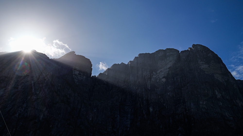
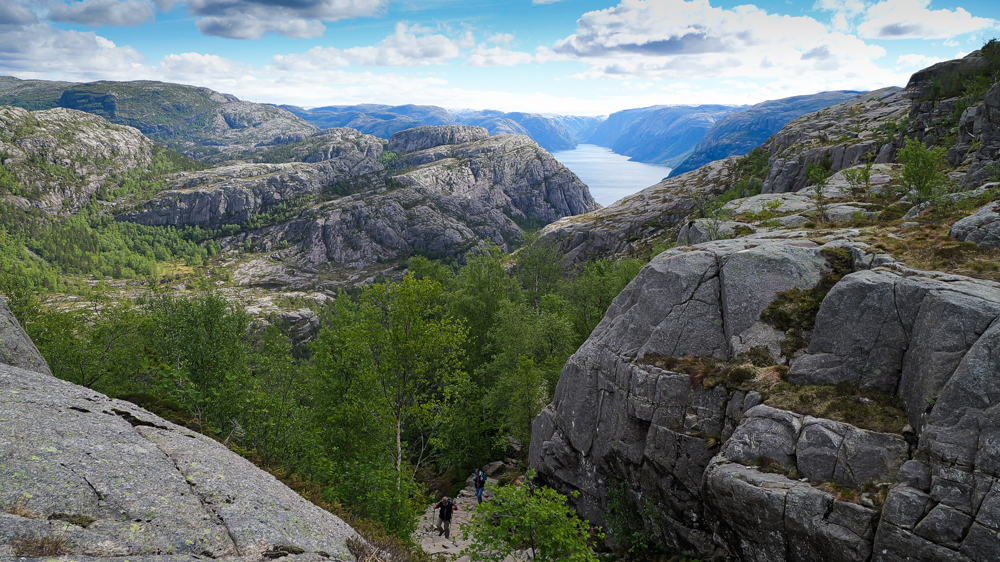
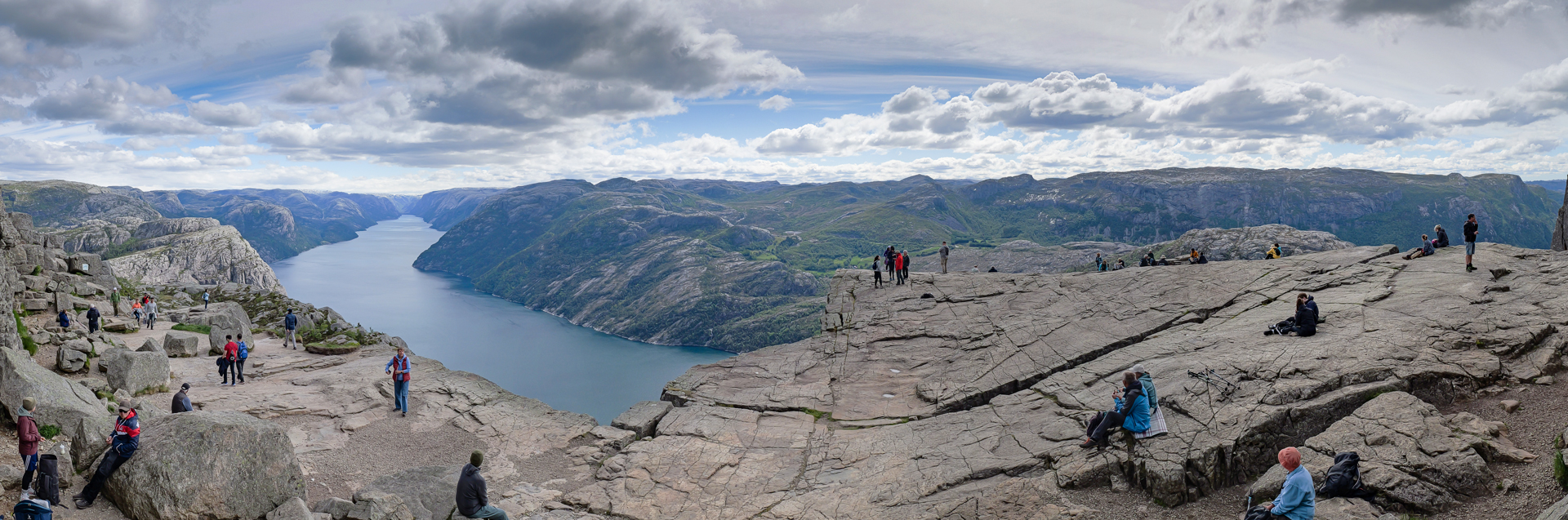
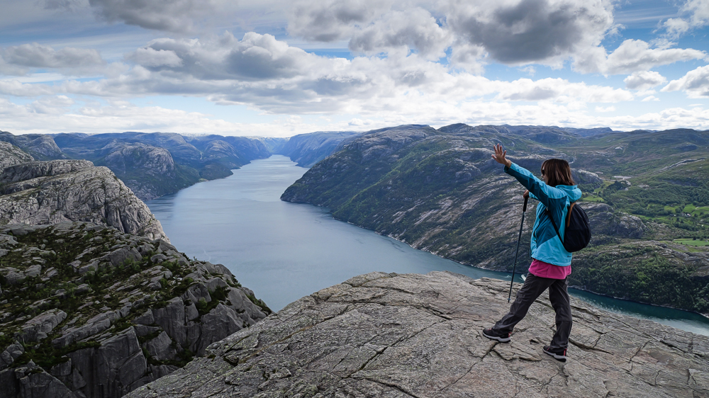
Then, we finally reach the top of Norway’s most famous rock – amazing view.
Still not too many people around – just a few from a guided hiking tour being constantly reminded not to jump off the rock. A few guys at the edge of the rock hunting for the ultimate selfie, no one really wants to see later. And a guy on his knees trying to snap a shot from below the rock. So, real action – feels like any moment now, a tourist might slip straight into the eternal hunting grounds.
On the way back, we finally run into the hordes of all the tours and a few 100 cruise shippys in shiny golden sneakers, neatly divided into several groups – each with their own number and watchdog.
Finally, the question remains: is it worth visiting such a hotspot? Well, if you’re lucky enough to escape the crowds, it’s ok. But don’t expect a big adventure. The trail feels more like it’s designed for cruise shippys on their once-in-a-life-adventure trip than for anyone looking for a real hard survival experience.
Kinsarvik, 24th May
The next morning, we’re on our way to Odda at Hardangerfjord. About 200km to drive on good but often pretty narrow roads.
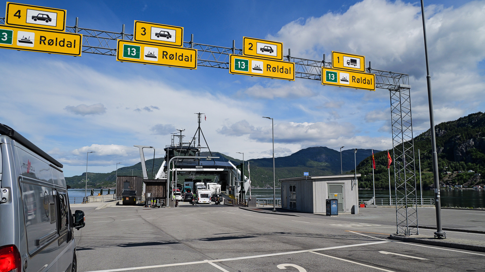
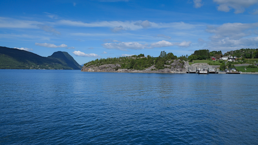
After a while, a short ferry crossing over the Jøsenfjord.
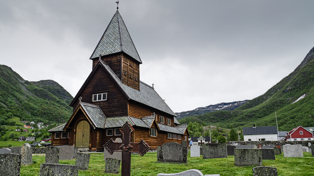
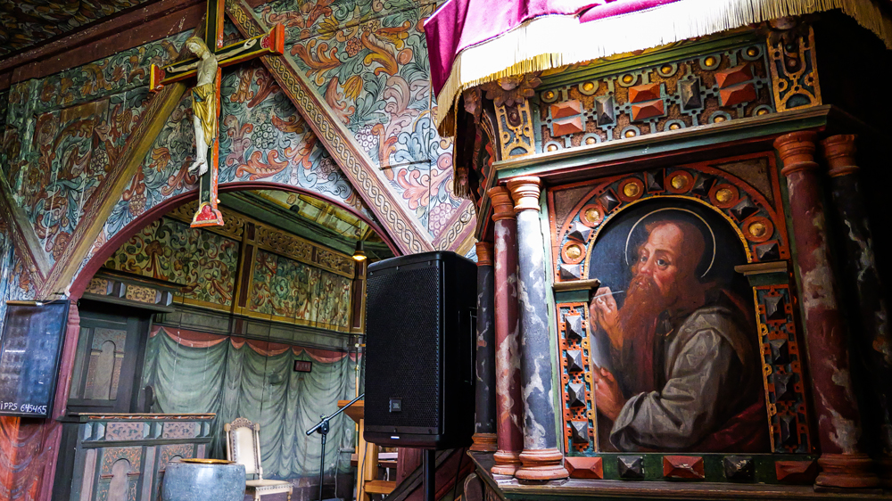
In the village of Røldal, we visit their famous stave church. Despite the steep entrance fee, it’s definitely worth seeing – at least, to see 1 of these churches while in Norway.
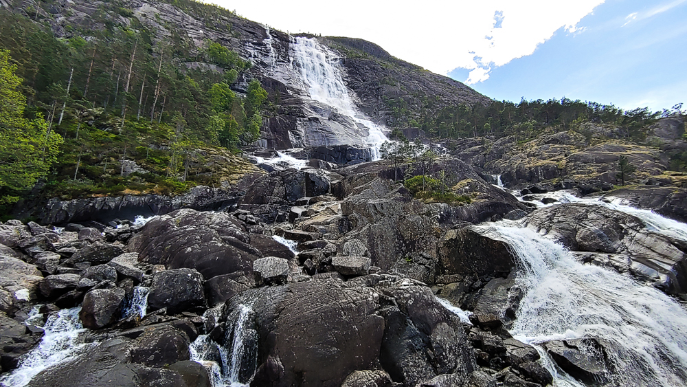
On we drive to Langfoss – at over 600m, it’s 1 of the highest waterfalls in the world. It’s so tall, it’s hard to realize that.
A few km later, the Låtefoss. Even though it’s smaller than Langfoss, it’s much more visible – somehow more impressive.
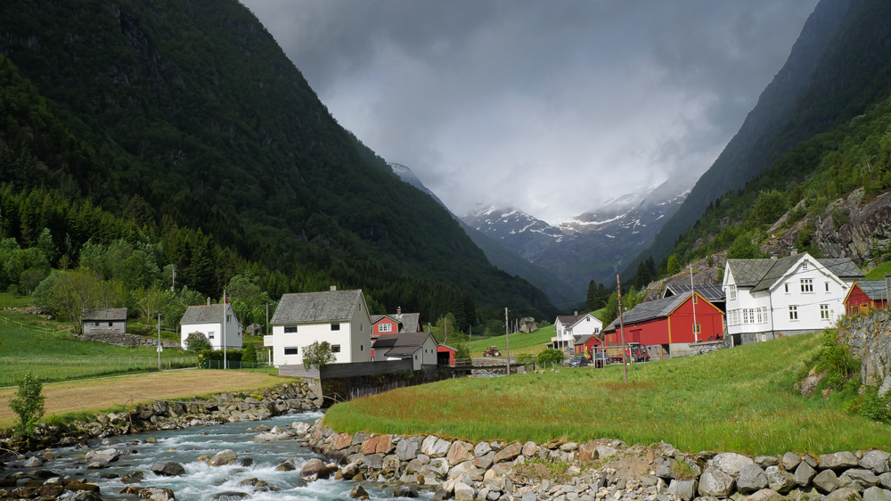
By late afternoon, we finally arrive in Odda at a campsite next to the lake.
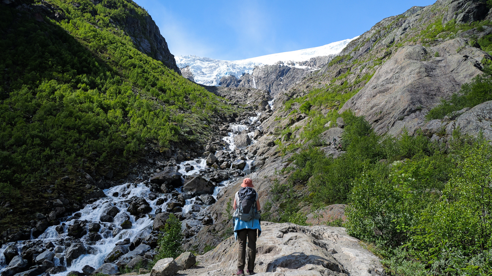
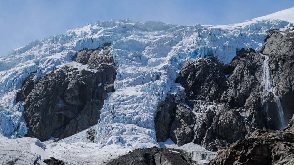
The next morning: we’re on our way to the Buarbreen. A highly recommended hike to the foot of this impressive glacier.
True, the weather doesn’t seem perfect – but let’s see how it develops.
The 1st few km a narrow road – just wide enough for a van, as long as there’s no oncoming traffic.
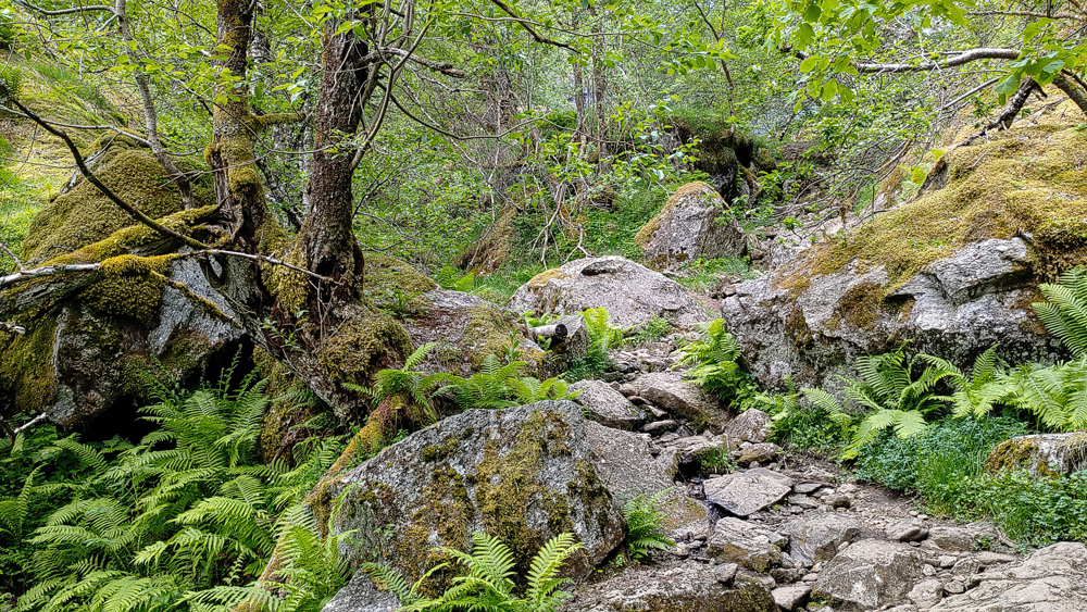
The trail starts off pretty harmless. Thru blooming meadows, then into the forests. A few steep’n’rocky sections along the way.
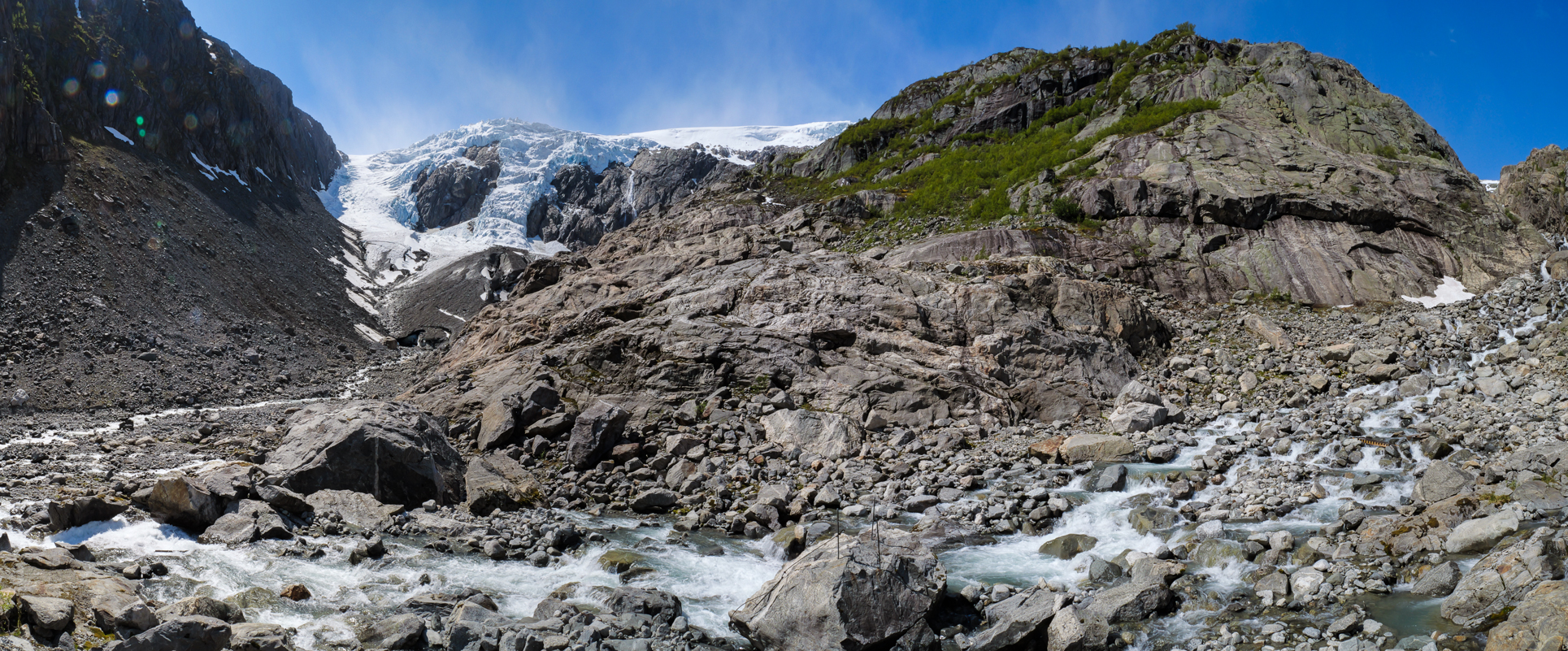
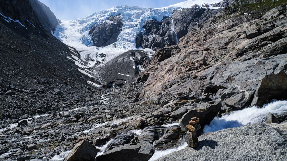
Constantly visible in the background – the glacier.
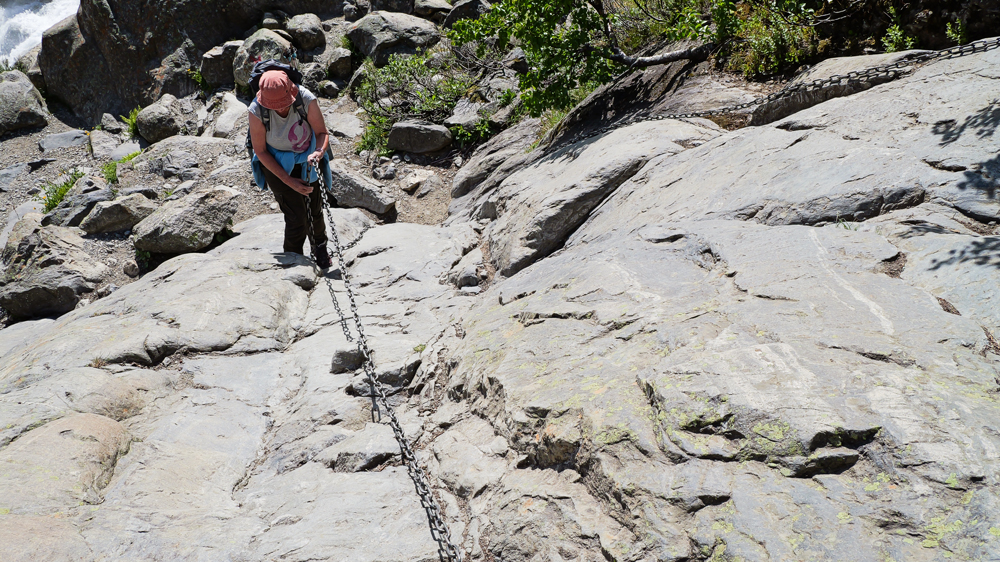
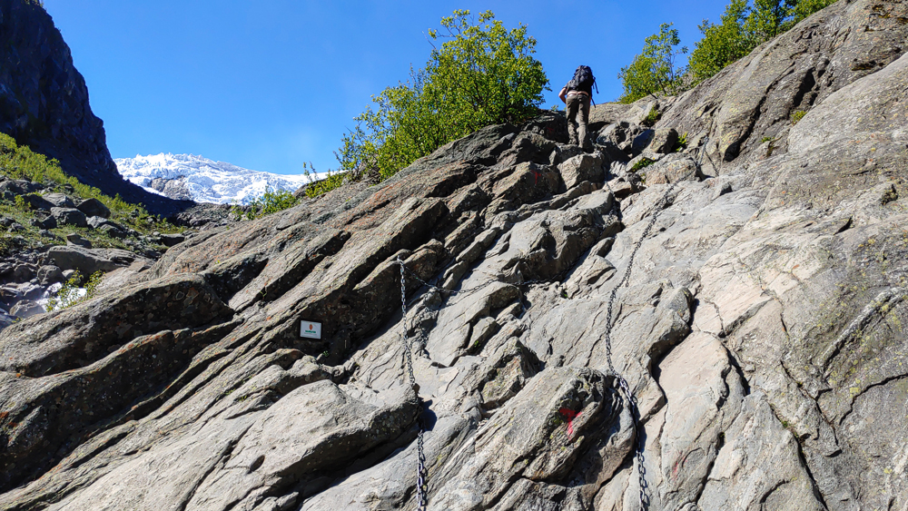
After a while, the vegetation thins out, and the trail gets steeper and rockier. There are several steep sections where you have to climb using chains, which definitely makes things more interesting.
After 2h, we reach the glacier. Luckily, the weather is showing its best side.
The only downside is we can’t really get close to the ice. A river still full of water washed out the bridge.
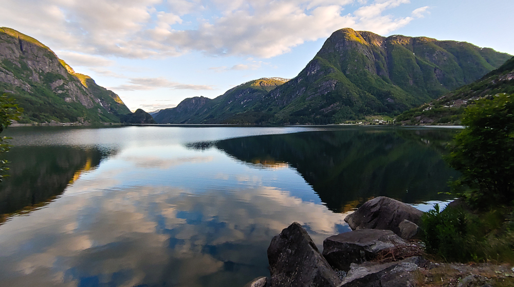
After returning to the parking lot, we head to Kinsarvik. About 70km along a side arm of the Hardangerfjord.
So, dear readers of this extraordinary post, surely you´re even more exhausted than we are, from reading all this boring stuff. But don´t worry, your suffering is over – at least until the next post is published. Somewhen in the near future.
Cheeeers
Monika’n’Martin